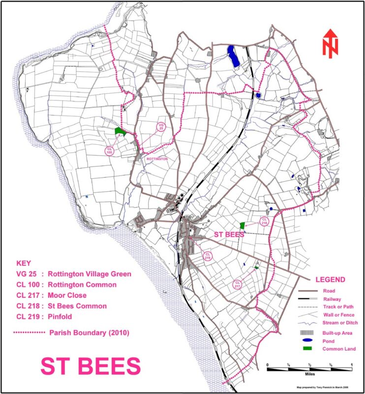
The Parish of St. Bees stretches on the coast from Barrowmouth in the north to Coneyside in the south and includes some of the best coastal scenery in the north west of England: the St Bees Head Heritage Coast.
St. Bees civil parish includes St Bees village and the hamlet of Rottington.
The parish boundaries were revised in 2010 to those shown on the map. Previously it extended to the River Keekle and included the Westlakes Science Park and parts of Moor Row; following the old mediaeval boundary.
There are several pockets of common land, managed by the Parish Council.